The following example illustrates how you can mix two display modes:
Normally, the plugin won’t allow to use markers and colored regions on one map. This is mainly due to the Google Geochart API. Since there is no way to achieve this by natively using the API, we will have to create two seperate maps. We use CSS to position the maps over each other. At the end you will have a map that looks like the one from above.
If you want to use this technique on your site, then you can do the following:
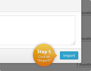
- Import both maps from below. Simply click on the download button and follow the instructions there.
- Once this is done, insert the maps on site (pages, posts, etc.) by using the following HTML. Please note that the order of the shortcodes is important. The first shortcode is the regions map and the second the markers map. Please make sure to insert the correct ids for the maps. :
<div id="mixed_display_modes"> <div class="region_map"> [interactive_map id="102"] </div> <div class="marker_map"> [interactive_map id="103"] </div> </div> - It is also necessary to make sure that the following styles are applied. If you import the maps from below, you can skip this step since you won’t need to add the following CSS. They are already included in the map template of the markers map. If you want to use this technique with already existing maps, then make sure that you use the following CSS (together with the HTML from before):
#mixed_display_modes {
  position: relative;
}
#mixed_display_modes .marker_map {
  position: absolute;
  width: 100%;
  pointer-events: none;
  top: 0;
}
#mixed_display_modes .marker_map text,
#mixed_display_modes .marker_map circle {
  pointer-events:visible;
}
#mixed_display_modes .marker_map path {
   display: none;
}
#mixed_display_modes .marker_map rect {
   fill: transparent;
}
You can also use a different region after the import. You only have to make sure that you use the same regions on both maps.
The map configuration of both maps can be found here:
| Name | Value | Description |
|---|---|---|
| Region | United States | List with all available regions |
| Width | auto | Width of the map in pixel. 'Auto' means that the map is centered in the available width. |
| Height | 350 | Height of the map in pixel. 'Auto' means that the map is centered in the available height. |
| Display mode | Regions | Specifies the display mode of the map. |
| Border resolution | Provinces | The resolution of the map borders. |
| Tooltips | Off | Allows to display a tooltip for highlighted map elements. |
| Tooltips: Trigger | none | The user interaction that causes the tooltip to be displayed. |
| Tooltips: Use HTML | Off | Specifies if the tooltips should use HTML. This allows to customize the tooltips even more. For example, if this property is on, it is possible to display images wihtin the tooltip. |
| CSS | .map-lightbox h1 {
margin-top: 0;
}
.featherlight-content {
border-radius: 5px;
}
.address_wrap {
padding-bottom: 20px;
}
.address_wrap a {
font-weight: bold;
color: #535099;
}
#{cssid} .tooltip-title {
white-space: nowrap;
text-align: center;
}
#{cssid} .google-visualization-tooltip {
border-radius: 20px;
}
#{cssid} .google-visualization-tooltip-item {
padding: 0 15px;
}
#{cssid} circle {
cursor: pointer;
}
body .featherlight {
z-index: 10000 !important;
} |
|
| HTML | <!-- Featherlight CSS -->
<link href="//cdn.rawgit.com/noelboss/featherlight/1.0.2/release/featherlight.min.css" type="text/css" rel="stylesheet" title="Featherlight Styles" />
<!-- Featherlight JavaScript -->
<script src="//cdn.rawgit.com/noelboss/featherlight/1.0.2/release/featherlight.min.js" type="text/javascript" charset="utf-8"></script>
<div id="{cssid}">
%%map%%
</div> |
|
|
JavaScript Executed when a marker/region is clicked. Click value can be defined for each map element. |
jQuery.featherlight(click_value); |
|
| Color | Name | Click Value |
|---|---|---|
| US-TX | TexasTexas /ˈtɛksəs/ (Spanish: Tejas [ˈtexas]) is the second most populous and second largest state of the United States of America. Geographically located in the south central part of the country, Texas shares an international border with Mexico to the south and borders the U.S. states of New Mexico to the west, Oklahoma to the north, Arkansas to the northeast, and Louisiana to the east. Texas has an area of 268,820 square miles (696,200 km2) and a growing population of over 26.9 million residents (July 2014). |
|
| US-SC | South CarolinaSouth Carolina Listeni/ˌsaʊθ kærəˈlaɪnə/ is a state in the southeastern United States, bordered to the north by North Carolina, to the south and west by Georgia across the Savannah River, and to the east by the Atlantic Ocean. The Province of South Carolina became a slave society after rice and indigo became established as commodity crops. From 1708, a majority of the population were slaves, many born in Africa. |
|
| US-IL | IllinoisIllinois (Listeni/ˌɪlɨˈnɔɪ/ IL-i-NOY) is a state in the Midwestern United States. It is the 5th most populous state and 25th largest state in terms of land area, and is often noted as a microcosm of the entire country.[6] With Chicago in the northeast, small industrial cities and great agricultural productivity in central and northern Illinois, and natural resources like coal, timber, and petroleum in the south, Illinois has a diverse economic base and is a major transportation hub. |
|
| US-FL | FloridaFlorida Listeni/ˈflɒrɪdə/ is a state in the southeast United States, bordered to the west by the Gulf of Mexico, to the north by Alabama and Georgia, to the east by the Atlantic Ocean, and to the south by the Straits of Florida. Florida is the 22nd most extensive, the 3rd most populous,[4] and the 8th most densely populated of the United States. Jacksonville is the most populous city in Florida, and the largest city by area in the contiguous United States. The Miami metropolitan area is the eighth-largest metropolitan area in the United States. Tallahassee is the state capital. |
|
| US-GA | GeorgiaGeorgia (Listeni/ˈdʒɔrdʒə/ JOR-juh) is a state located in the southeastern United States. It was established in 1732, the last of the original Thirteen Colonies.[4] Named after King George II of Great Britain,[5] Georgia was the fourth state to ratify the United States Constitution, on January 2, 1788.[6] It declared its secession from the Union on January 19, 1861, and was one of the original seven Confederate states.[6] It was the last state to be restored to the Union, on July 15, 1870.[6] Georgia is the 24th largest and the 8th most populous of the 50 United States. |
| Name | Value | Description |
|---|---|---|
| Region | United States | List with all available regions |
| Width | auto | Width of the map in pixel. 'Auto' means that the map is centered in the available width. |
| Height | 350 | Height of the map in pixel. 'Auto' means that the map is centered in the available height. |
| Display mode | Markers | Specifies the display mode of the map. |
| Border resolution | Provinces | The resolution of the map borders. |
| Tooltips | Off | Allows to display a tooltip for highlighted map elements. |
| Tooltips: Trigger | none | The user interaction that causes the tooltip to be displayed. |
| Tooltips: Use HTML | Off | Specifies if the tooltips should use HTML. This allows to customize the tooltips even more. For example, if this property is on, it is possible to display images wihtin the tooltip. |
| CSS | .map-lightbox h1 {
margin-top: 0;
}
.featherlight-content {
border-radius: 5px;
}
.address_wrap {
padding-bottom: 20px;
}
.address_wrap a {
font-weight: bold;
color: #535099;
}
#{cssid} .tooltip-title {
white-space: nowrap;
text-align: center;
}
#{cssid} .google-visualization-tooltip {
border-radius: 20px;
}
#{cssid} .google-visualization-tooltip-item {
padding: 0 15px;
}
#{cssid} circle {
cursor: pointer;
}
body .featherlight {
z-index: 10000 !important;
}
#mixed_display_modes {
position: relative;
}
#mixed_display_modes .marker_map {
position: absolute;
width: 100%;
pointer-events: none;
top: 0;
}
#mixed_display_modes .marker_map text,
#mixed_display_modes .marker_map circle {
pointer-events:visible;
}
#mixed_display_modes .region_map {
}
#mixed_display_modes #{cssid} path {
display: none;
}
#mixed_display_modes #{cssid} rect {
fill: transparent;
}
|
|
| HTML | <!-- Featherlight CSS -->
<link href="//cdn.rawgit.com/noelboss/featherlight/1.0.2/release/featherlight.min.css" type="text/css" rel="stylesheet" title="Featherlight Styles" />
<!-- Featherlight JavaScript -->
<script src="//cdn.rawgit.com/noelboss/featherlight/1.0.2/release/featherlight.min.js" type="text/javascript" charset="utf-8"></script>
<div id="{cssid}">
%%map%%
</div> |
|
|
JavaScript Executed when a marker/region is clicked. Click value can be defined for each map element. |
jQuery.featherlight(click_value); |
|
| Color | Name | Click Value |
|---|---|---|
| Los Angeles | Los AngelesLos Angeles (Listeni/lɒs ˈændʒəlɨs/ loss AN-jə-ləs),[14] officially the City of Los Angeles and often known by its initials L.A., is the second-largest city in the United States, the most populous city in the U.S. state of California, and the county seat of Los Angeles County. Situated in Southern California, Los Angeles is known for its mediterranean climate, ethnic diversity, sprawling metropolis, and as a major center of the American entertainment industry. Los Angeles lies in a large coastal basin surrounded on three sides by mountains reaching up to and over 10,000 feet (3,000 m). |
|
| San Francisco | San FranciscoSan Francisco (/sæn frənˈsɪskoʊ/), officially the City and County of San Francisco, is the cultural, commercial, and financial center of Northern California and the only consolidated city-county in California.[24] San Francisco encompasses a land area of about 46.9 square miles (121 km2)[25] on the northern end of the San Francisco Peninsula, which makes it the smallest county in the state. It has a density of about 18,187 people per square mile (7,022 people per km2), making it the most densely settled large city (population greater than 200,000) in the state of California and the second-most densely populated major city in the United States after New York City. |
Comments
If you need help or have questions, please leave a comment.